


Finding Shelter from Sudden Highland Storms
The Storm That Comes From Nowhere
You feel the first cold gust on the back of your neck. Ten minutes ago the glen was still and mild; now the cloud is down, the rain is horizontal, and the path has become a stream. In the Scottish Highlands, sudden storms are not a possibility but a certainty. The key is not to fight them but to find shelter, regroup, and wait.
That begins with a map and a keen eye for contour lines. They are not just about height; they tell you where the land folds, dips, and rises. Those folds can cut the wind enough to let you put on a jacket, eat a sandwich, and make a plan. The trick is to spot them before you need them.
Reading Contours for Shelter
On a 1:25,000 or 1:50,000 map, contour lines show elevation at intervals — usually 10 metres. When lines are close, the ground is steep; when far apart, it is gentle. But shape matters more than spacing.
- V-shaped contours pointing uphill mark a re-entrant or gully — a natural funnel that can break the wind if you tuck into the side.
- U-shaped contours often show a corrie or broad dip, a haven if the wind blows across the top.
- Closed loops with hachures (short lines inside) mean crags. They break the wind but also drop rocks.
- Widely spaced contours on a lee slope give gentler ground for pitching.
Always check the wind direction. If it blows from the west, seek a dip or crag on the east side of a ridge. If from the north, look for a south-facing hollow. Contour lines tell you where that hollow is, even before you see it.
Dips, Hollows, and the Art of the Fold
A dip in the contour is where the wind loses its punch. The best dips are shallow and broad, not deep and narrow. A narrow gully funnels wind and water, making things worse. A broad hollow, often a wide U-shape, lets you sit or pitch with your back to the worst of it.
Look for a "col" on the map — a saddle between two higher points. The lee side, just below the saddle, can be calm. Also watch for "re-entrants" — the V-shaped folds that cut into a hillside. They are usually damp, so avoid the very bottom if rain is heavy, but the side, a few metres up, can be perfect.
On the move, use your compass and map to anticipate. If the wind is at your back, the next dip ahead will be a windbreak. If it is in your face, the dip behind you is your retreat. Practise this in fair weather: pick a feature, walk to it, and feel how the wind changes.
Crags and Woodland: Nature's Windbreak
Crags are practical as well as dramatic. A line of crags forces the wind up and over, leaving a quieter zone at their base. The steeper the crag, the bigger the lee. But be careful: crags shed stones. Never camp directly beneath a crumbling edge. Look for a flat shelf a few metres out, where you are protected but out of the fall line.
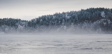
Woodland is even better. In the Scottish Highlands, native pinewoods and birchwoods often cling to lower slopes, especially below 300 metres. On a map, woodland is green shading. A patch of trees can reduce wind speed by half or more. But avoid dead or leaning trees, and never pitch under a lone oak or ash — they drop branches. A dense stand of Scots pine or rowan is ideal.
Above the tree line, look for dwarf willow or juniper. These low shrubs break the wind at ground level. Combine them with a contour dip and you have a micro-shelter that feels almost luxurious.
Wild Camping in a Sudden Storm
When the storm hits and you decide to stop, get out of the wind and rain fast. Use your map to find a spot that is flat, sheltered, and away from water. Contour lines help with the first two. A gentle lee slope, marked by widely spaced contours, gives a flat pitch. A dip or crag nearby gives shelter.
- Flat ground: avoid slopes, even gentle ones, where you will slide in the night.
- Shelter: a crag, a woodland edge, or a contour fold.
- Water: avoid the bottom of a re-entrant or a stream, which can flood quickly.
Pitch your tent with the lowest corner facing the wind, and weight the pegs with rocks if the ground is soft. If you are in a bothy, still check the map for the best route out. Storms in the Highlands can last hours or days. Sometimes the wisest move is to sit it out, brew a hot drink, and wait for the cloud to lift.
Practise these skills before you need them. On a calm day, find a dip on the map, walk to it, and see how it feels. Learn to read contour lines as a story of wind and shelter. Then, when the storm comes — and it will — you will know exactly where to go.


Hill Walks
-
Always learn the calls of meadow pipit, skylark, and raven to enrich a quiet walk on the hills.

Wild Camping



-

Long established fact that a reader will be distracted
-

Long established fact that a reader will be distracted
-

Long established fact that a reader will be distracted




Long Distance
Karla Gleichauf
12 May 2017 at 05:28 pm
On the other hand, we denounce with righteous indignation and dislike men who are so beguiled and demoralized by the charms of pleasure of the moment
M Shyamalan
12 May 2017 at 05:28 pm
On the other hand, we denounce with righteous indignation and dislike men who are so beguiled and demoralized by the charms of pleasure of the moment
Liz Montano
12 May 2017 at 05:28 pm
On the other hand, we denounce with righteous indignation and dislike men who are so beguiled and demoralized by the charms of pleasure of the moment